Obsah
- Webkamery
- Sprievodca
- Lezenie
- Lyžovanie
- Fotopotulky
- Voda
- Výlety Bratislava a okolie
- Vyhliadkové plavby
- Galérie, výstavy
- Príroda
- Noviny
- Noviny - titulné správy
- News from Slovakia
- What World Thinks
- Neighbors of Slovakia
- Zaujímavosti
- Vtipy
- Rýmovačky
- Kníhkupectvo
- Z produkcie Panorámy.sk
- Slovenčina pre cudzincov
- Folklór
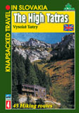
- Turistickí sprievodcovia - Slovensko
- Ivan Bajo: Smiech na lane
- Diktáty
- Slovakia
- Webcams, Online Cameras - Slovakia and Surroundings
- Slovakia Document Store
- News
- Slovak Language for Foreigners
- Trip Tips to Bratislava and Surroundings
- Bratislava - Vienna by a ship on the Danube
- Kontakty